Operational intelligence. Delivered instantly.
Advanced geospatial solutions for industry and government. Actionable data for mission-critical decisions.
Advanced geospatial solutions for industry and government. Actionable data for mission-critical decisions.
Supporting industry, government, and security leaders worldwide.

Geospatial intelligence for rapid, informed action.
Direct access to real-time imagery and data.
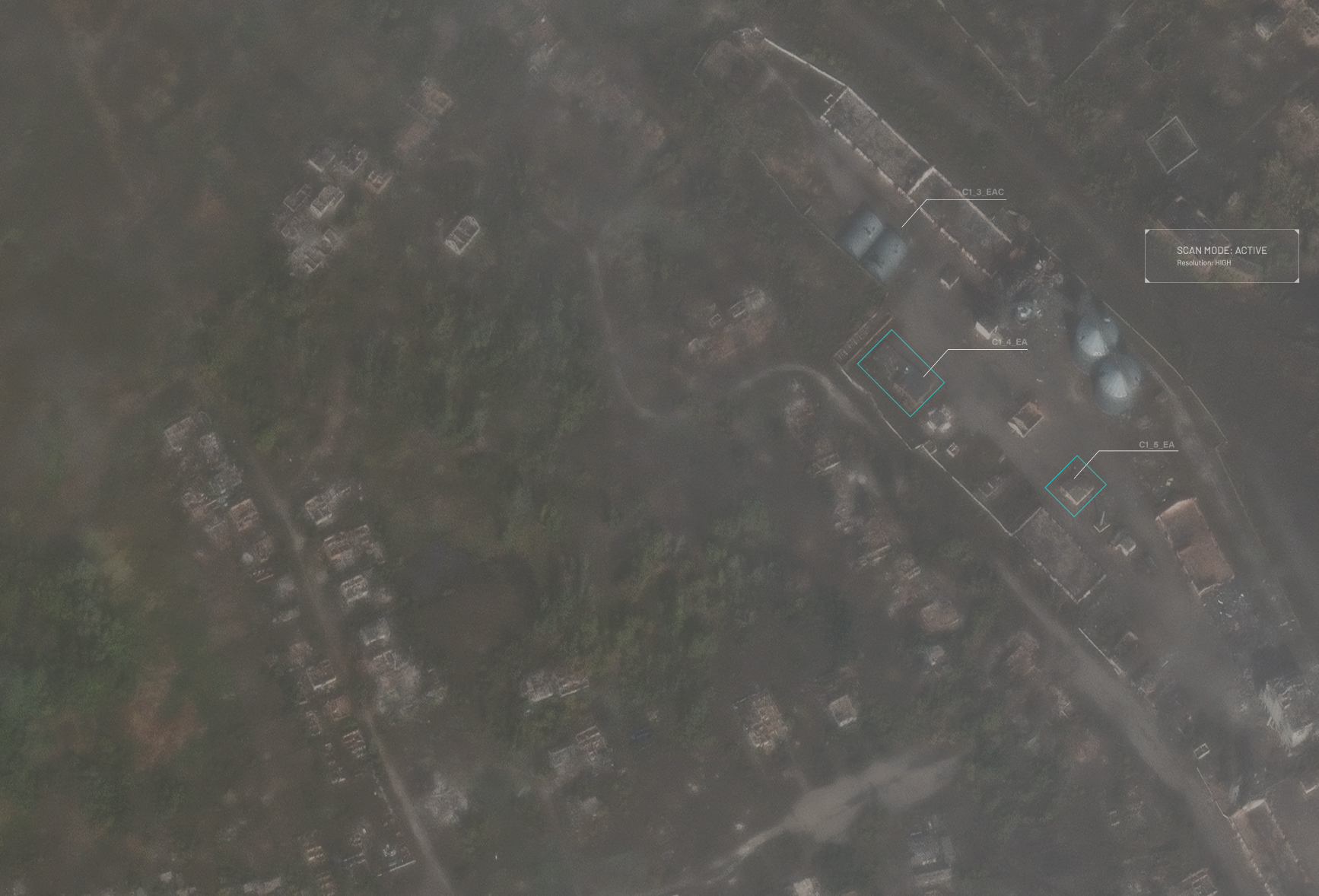
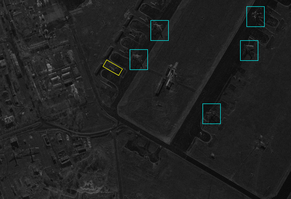
Detect threats and changes in any condition.
Seamless data for unified operations.
“Bravo1Alpha’s insights accelerate our response.”

Satellite support
CSS missions
Value of satellite-enabled operations delivered.
GEOINT integration
Objective reports
Increase in mission planning efficiency.
SAR analytics
Terrain scans
scans processed.
System integration
C2 platforms
Unified data feeds for command systems.
Training & advisory
Workshops
Personnel trained in GEOINT workflows.
Rapid response
Tasking requests
Satellite tasks completed for field teams.
Our solutions deliver real-time, actionable GEOINT - empowering industry and government teams to make critical decisions with confidence.
Bravo1Alpha’s satellite support is a game-changer - delivering precise intelligence exactly when it matters most.
![[team] image of individual team member (for a hr tech)](https://cdn.prod.website-files.com/699d07262de198aaf1a90758/699db2dcef21b4b3c2461f5e_Bravo_1_Alpha_2025.gif)
Clear, direct answers on GEOINT and satellite support for industry, government and security operations.
Reach out for secure GEOINT support.